RUN.EAT.GOSSIP

Showing posts with label Trail. Show all posts

Sunday, December 07, 2014

End of the Road - Tampines Mountain Bike Trail

On 1 December, the Tampines Mountain Bike trail officially ceased to exist. To make way for another housing estate to house the 6.9m population.

I first discovered this place right in the backyard of Tampines town way back in 2008. Back then, it was one big place with some challenging knolls, some small streams to cross and many many small trails criss crossing the places. Although not technically very challenging, it was a worthwhile alternative to the crowded MacRitchie. The only problem then was that it was a very rugged place without any toilet facilities and shelters. 

You can see more photos of the original trail here when we did a Eastside Trail Run.

Then in 2010, it was split into the Tampines Mountain Bike Park and Mountain Bike Trail for the Youth Olympic and 3/4 of the place was taken away from non-mountain bikers. Still there was a good enough 5 trail with a challenging 1 km narrow jungle trail complete with mud pool and stream, a small climb and breathtaking scenery.

When I moved to Pasir Ris, I ran there more often as it was just a 10 minutes run from my home. It was literally a run in my own backyard. But last year, the government announced plans to redevelop the area for Tampines North estate and that sounds the death knell for the place. After a short reprieve, the Bike Park closed last month and this month, the Bike Trail closes too. I managed to do a literally final run there on the morning of the closure. As I came out of the trail, the workers were putting up the fencing at the trail head. 

Here are the final photos of the place. 

The 1km stretch of jungle trail that is permanently muddy and wet. I have a video of a run I did there sometime ago in the mud and water. Rather long and boring but if you don't mind taking a nauseating ride through the choppy video, the link can be found here


There are lot of wide open field like this with narrow trail

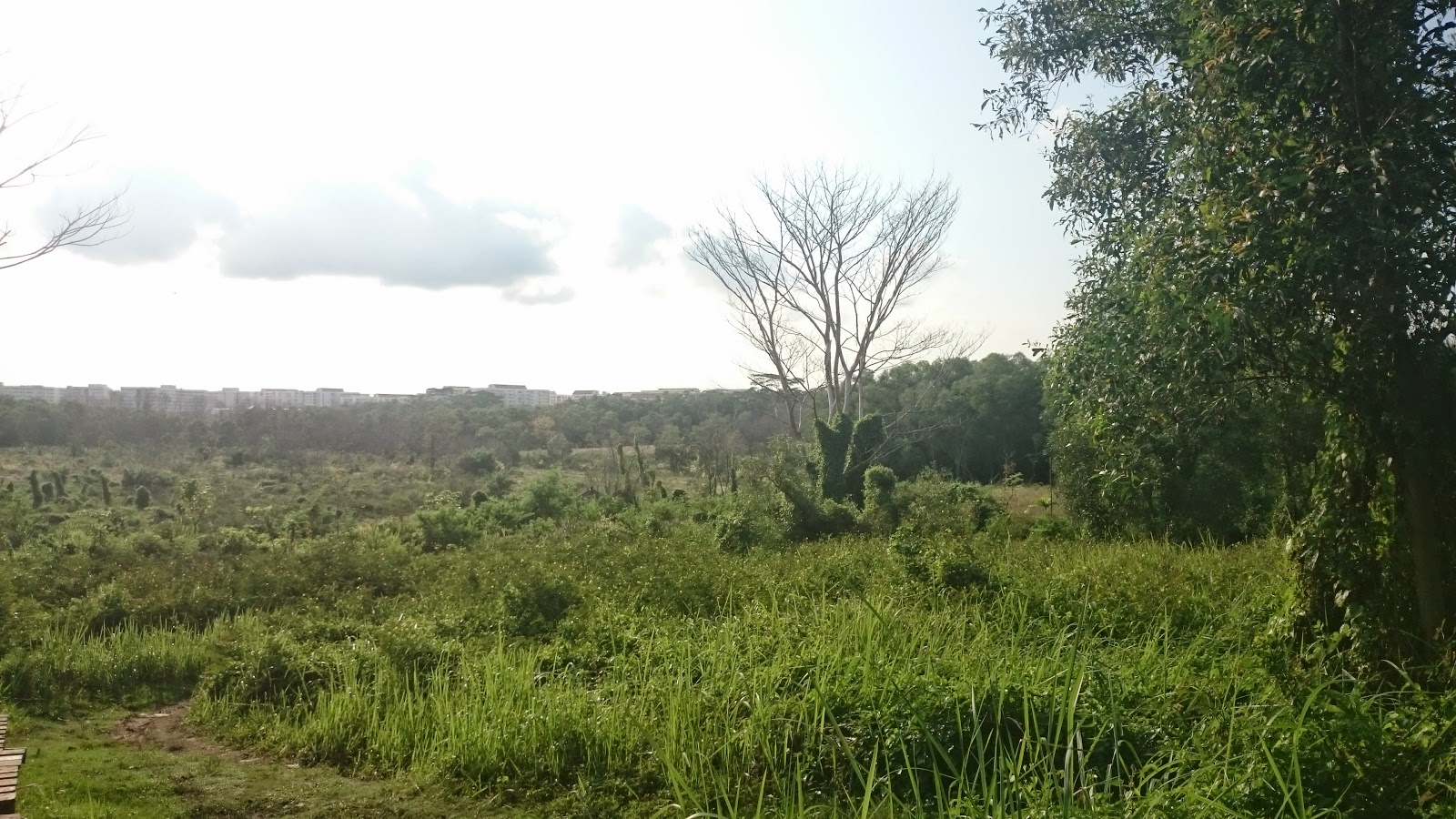
The view from the top of one of the small hill

This is my favourite part of the trail. Running under this canopy of trees

The death knell. Closed and gone but cherished with fond memories.
 

Thursday, November 13, 2014

Arthur's Seat, Edinburgh, Scotland

In Edinburgh, we were a bit lost what to do. We had visited the Royal Mile the day before and didn't particularly fancy going back there. We also had no desire to visit castles and museums of which there are plenty.

Then we discovered Arthur's Seat, an extinct volcano. But we didn't know that. We only knew there was a hiking trail just 20 minutes walk from our B&B and there was a small hill to climb. After getting direction from the boss of the B&B, we walked and came to this place with this signboard


Alright, we were right on target. No losing the way this time round.

And this was our target or so we thought.

But actually this is just the first of the range we got to climb to get to the top which is this one.

Yep, the pointy one right at the back at the far left corner

The climb up the 250 metres summit was fairly easy and straight forward. We could follow this road 

Or just walk up the side of the hill

In cool weather, the climb up was much easier than climbing our 163 metres Bukit Timah Hill. But even at a miserly 250 metres, the view it offered of the surrounding city of Edinburgh was stunning. 

The view of Edinburgh at mid point

And the views from the summit


Yes we almost there at the summit

 I want to fly up instead of climb up

And we there

Coming down, we transverse another few hills with tracks and trails leading left right centre


This has got to be a trail runners dream training ground. And indeed there were a few runners criss crossing the hills.  How I wish I was dressed for running!

And then there this ruins of an old abbey which overlooks one of the smallest loch in Scotland and a real life Palace!

St Margaret Loch

Holyrood Palace

But all good things must come to an end and so finally we reluctantly made our way down to find lunch. Now who want to join me come here chiong sua?

Sunday, October 26, 2014

Glen Nevis - Steall Fall, Scotland

Continued from Glen Nevis - Lower Falls,

In the end we decided to continue on. Why? Because we could see other people driving in so we figured since there are people still going in, it should be fine. And so we walked on the road. We managed to overtake the other couple who was resting by the road side. Thank goodness we are fit as a fiddle:)

The sidekick walking up the single track road.

And finally we came to this sign!

Yes we finally found it. After trekking for almost the whole day, we reached the trail head to the Steall waterfall. It was now almost 5 pm. How far to the fall and how much time do we have? And more ominously, there was this sign at the start of the trail head. 

How difficult was the hike? I didn't seem to recall any bad write up about the journey there though and since we had went through so much to reach here, I wasn't going to be deter by 1 small puny little sign. So off we went.

The initial part was fairly easy and a no brainer. Narrow but flat trail notwithstanding that we were walking next to a gorge the like of which we city folks have never seen before.


Talking about the gorge. We have never seen a real life gorge before except in the movies and this was like something from the movie. Can't really tell from the following 3 photos but this was as close as I dare to get to take the shots without fear of dropping in. It look deep and rocky with water rushing through it. A fall would likely be death - either from hitting the rocks or being swept away into the depth of the gorge.


And if that was not bad enough, we were literally walking right next to it on a small rocky ridge.


But truth be told, it wasn't that bad and quite easily negotiated. And after some walking we finally came out to the open!

And after turning the corner, there it was! The Steall waterfall right at the back of the photo

 A closer look at the Steall fall. Not as spectacular as expected. Supposed can go nearer but to reach it, we have to cross the river. We didn't want to get our feet wet so we were contended to admire it from afar. But there is another way to reach it without getting the feet wet.

And that is by using this rather aptly name Steall bridge. Only problem with this bridge is, there is only 3 wire ropes on it. 2 on top for the hand to hold and 1 below to walk on!

Like what this lady is doing. And we, we chickened out!

But finally after almost 8 hours, we seen the Steall Waterfall and concluded our trip to the Highlands on a high.

Tuesday, October 21, 2014

Glen Nevis, Lower Falls, Scotland

Continue from Glen Nevis - Cow Hill Summit

After lunch at a lovely place, we finally we found our way to a waterfall but before passing through a beautiful scape of farmland and the base of the highest peak in the United Kingdom, the Ben Nevis.

Lunch in this cosy little place


 The Ben Nevis is somewhere to the right of this mountain range and this path will lead right to it. Too bad we were not prepared for climbing otherwise would love to scale this peak which at 1344 metres is the highest mountain in UK and which can apparently be done with in half a day!


Back to the waterfall. We came to this waterfall. There were a few cars parked there so we thought this is it.


But unfortunately after walking for almost 1 hour, we did not see the Steall fall, the one that we had came all the way for. We did see some waterfall further away but they didn't look like anything in the photos we seen.


We were in the wrong place again! Despite the nice scenery along the way, I was kinda getting depressed and real disappointed.


Was this going to be a fruitless trip? We met another couple and they too were looking for the Steall fall. They figured we were in the right direction but at the lower reach and had some more distance to cover. It seems we had stopped at the wrong waterfall and there was another 3 miles to go to reach the Steall fall. It was getting late and I wasn't enthusiastic about reaching it on time before darkness set in.

Finally we came to a bridge with water cascading down from the river. This has to be the fed from the Steall fall! But how were we to get there. 


After crossing the bridge, we were out of the trail and back on the road. The couple decided to walk up the road. We toyed with whether to turn back via the road and drive up or follow them. It was now around 4.45 and we had wasted 1 hour. We had absolutely no idea how far away it was. Were we too late to make it to the Steall fall? Would it be dark by the time we get there?

Continue here

LinkWithin