RUN.EAT.GOSSIP

Showing posts with label Local Sights. Show all posts

Tuesday, February 10, 2015

Top of the World

Well not quite since the highest point in Singapore is only just slightly over 160 metres. But that is Bukit Timah Hill and Bukit Timah hill is now close so the next highest point is Mt Faber at 105m and that where are the trail runners looking to race overseas are flocking to now that they are deprived of good old Bukit Timah.

I followed 1 group last week and did just 1 loop of the hill. One can get a pretty nice view of the Telok Blangah Estate from the top of the hill. The view stretches all the way to Orchard Rd. On the other side of the road, one can see Sentosa, the cable cars and on a clear day, some islands of Indonesia. Instead of using my own lousy camera to show the view from the top, here is a VR taken by Singapore top VR photographer, Aram Pan. Guess what? I am mentioned inside the post! Cheap thrill!

The beauty of running around these areas is that there are several high ground where you can have that top of the world feeling and look out far far away.

From Mt Faber, I went on to Telok Blangah Hill crossing the beautiful Henderson Waves Bridge. And right smack in the middle of the bridge which is 36 metres high you get these awesome view.


Looking southward towards the sea
The Telok Blangah and Bukit Merah estates
After the Henderson Waves Bridge is the Telok Blangah Hill. There are some mean slopes here including a very short and steep one up to Terrace Garden where you can another panoramic view.


Standing between Telok Blangah Hill and Kent Ridge is a patch of forest and over this is a series of metal bridge called the Forest Walk hovering over the forest. And beside being able to see the flora and fauna close up, one can get another great view of the far beyond.


After crossing the bridge, its up to Kent Ridge Park and here there is a series of zig zag path which leads to what is known as the Canopy Walk which comes with a view of the Hort Park below it.


From here it is a straight run down Kent Ridge Park. That is the easy part. But coming back up, there is either the long and steep Pepys Road or the other long and steep Vigilante Drive. By now after conquering the up and down from Mt Faber to Kent Ridge, I was well and truly beaten and could only managed to walk up Vigilante Drive. At the top of course the reward is another top of the world view.


All in, depending on how one runs, one can do up to 20 km covering Mt Faber, Telok Blangah Hill, Hort Park, Kent Ridge Park with total elevation of more than 500 metres. Not a lot by any other measures but certainly a good enough workout for those who want to do some serious hill runs and get many great view at the same time.

Here is the elevation for the run last week


Monday, January 12, 2015

Merlion Run

Group run is fun when you are running with a group of great people and there is no competitive element, no time pressure, no stress and no need to worry about being named and shamed for taking short cut ahem... diverted route.

So after a long absence of group run in 2014, I ended 2014 with a group run and started 2015 with another group run. This time round as a sort of informal and unofficial SG50 event, a group of us decided to run to the five official Merlion.

We started at the Seah Im carpark at Telok Blangah and went to the first Merlion on our list at Sentosa. But enroute, we found another Merlion. A multi-colored Merlion in fact.
Photo Credit Lionel Cheng/Neyton Tan via wefie
But this is the official one that we came to see

From Sentosa it was on to our next destination at Mt Faber. Unfortunately not by cable car though. We had to run there up the 100 metres or so "high" hill. Poor me legs.

Fortunately it was all downhill from here although our very fierce leader made us run from here all the way to Orchard Rd where we sneaked into the Tourism Board office for this group photo with the very malnourished looking Merlion.

We also discovered there are actually more than 1 Merlion here.

But we have to move on to the last 2 Merlions. The anak Merlion and Papa Merlion in the background.
Photo credit Lionel Cheng
And here is a better view of Papa Merlion

Group run can be real fun and there always one going on organised by one group or another. For those just starting out running, this is a great way to get started on running, make new friends and get tips and see places. So if you are free, look out for such events on FB and why not join one?

Tuesday, July 29, 2014

Singapore Sports Hub

The new Singapore Sports Hub and National Stadium has now been opened for about a month and during this period, the public are free to use some of the facilities. Like all the curious people, we went to look see look see.

Unlike the old National Stadium which is just a sports stadium with a cluster of smaller facilities nearby, the new stadium is housed in an integrated complex. The new complex called the Sports Hub have beside the stadium, an aquatic centre with swimming and diving facilities, tennis, badminton and basketball courts. There are also beach volleyball courts, watersports facilities for sailing, kayaking and dragon boating. 

The main complex comes with a retractable roof so no more wet soccer pitch


There is also a 880 metres running track outside the stadium itself for the public to run around.
The sidekick doing the obligatory run round the stadium
The new stadium beside the retractable roof also has arrangeable plastic seats. Somehow it feels a bit different from the nice wooden seats which has since been turned into decorative benches and placed all over Singapore.

Monday, June 09, 2014

Trail Splashing

A video of the water logged trails at the Tampines Mountain Bike trail. Video a bit long at 7 minutes though :) but the last bit is more fun.


Great place to run in

Friday, June 06, 2014

Bukit Timah Nature Reserve

The biggest news this week for runners; oh okay, for trail runners at least; this week is probably not the Sundown Marathon but the forthcoming closure of the Bukit Timah Nature Reserve. 

Like most of the trail running friends, I too will miss the place not that I like it very much. But for trail runners and mountain climbers, this is the only place where one can get a decent workout while training for overseas trail races like the multiple trail races in Hongkong, Sabah, Vietnam and other countries nearby. For climbers, this is the only place to train in Singapore, inadequate as it may be at 163 metres high. Most of us who trains there are attracted to the 2 long flights of rickety staircases from Dairy Farm to the Summit.


So everybody training plans will be rudely shattered. There is absolutely no other place in the whole of Singapore that is similar in nature or has the ascent, limited as Bukit Timah Hill is. The next highest peak in Singapore is the 105 metres high Mt Faber and there are no steps like what Bukit Timah has. Which bring me to my wish list and what I hope to see/not to see from the repair/upgrading of the place.

1. No concrete steps. The uneven crooked steps are the main draw of the place for all those training at the place. This is the closest we can get to climbing and is similar to the steps in the Hong Kong trails. What I hope is that Nparks do not replace them with concrete evenly spaced steps like those at Mt Faber. Sure, concrete steps will be easier to walk for the multitudes of park visitors but it will kill the whole ruggedness of the place. So my hope is that these steps will be repaired where necessary but will remain. 

2. Minimum boardwalk. I know boardwalk protect the creatures and the on the ground but what we want is a rugged trail, soil mud and dirt. Install boardwalk only at the most vulnerable areas. Keep the place as natural as possible. If there is really a need to keep people off the side of the trail, perhaps having railings made of natural recycled wood and plants along the side of the trail might do the trick of preventing users from encroaching into the forest.

3. A proper toilet and a small cafe. Something like the Amenities Centre at MacRitchie Reservoir. Toilet should be big enough to accommodate the increased number of visitors that is expected to throng the place after the re-opening. It should also come with shower facilities for visitor to bath and change after trekking. A small cafe will be great for visitors to rest, have a drink and some refreshment. Oh a water cooler at the summit might be nice too.

4. Better accessibility. Currently there is no public transport to the place. Perhaps introduce a paid shuttle bus service from either Clementi or Bukit Batok MRT station on weekends. That will hopefully reduce the number of people who drives there and clogging up the roads and polluting the air.

5. Not a sanitized park. Last but not least, not another Bishan Park, Sengkang Riverside Park or Admiralty Park where everything is nicely cultivated and demarcated. No nice paved walkways, no granite chip trails and no cement stairs what is slowly happening at MacRitchie Reservoir Park. Minimum changes from current  and keep the place as natural as possible. Retain its ruggedness. After all that is what endeared most people to Bukit Timah Hill.

Friday, November 01, 2013

Running Home - Toa Payoh to Pasir Ris

I haven't run home from work for quite a while. I was in Toa Payoh attending a course so I decided to run home from there rather than take the train home. I checked the distance on Google Map and and it was about 16km via the car route. I reckoned that the route by foot should be almost the same except that I will not go up the Kaki Bukit Viaduct.

I started from Toa Payoh Lorong 4 at about 5.45 pm. It was a short run out of Toa Payoh to Braddell Road. At junction of Lorong 1 and Lorong 6, I passed the magnificent Toa Payoh Seu Teck Siang Tong, a Taoist temple. Took this picture with my phone from across the road against the light so the picture doesn't show how impressive the entrance to the temple is. For a closer look, try this link

Braddell Road is not a very nice place to run, with heavy traffic. I don't like to breath in fumes but no choice, this was the only practical way to go back. But I did get a view of the cleaned up Kallang River.

I supposed I could follow the course of the river all the way down to Bendeemer Road and run home from Kallang or Sims Drive but that could be detouring too much and I didn't really feel like doing an extended distance run.

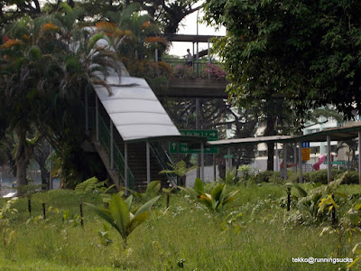
So I continued and reached Bartley Road and on my right was this lush green space. It was breath taking and I haven't run here before. Trails for exploration? 

Another view of the place further down the road. This is of course part of the Mount Vernon cemetery if I am not wrong. I should go there before it makes way for some condominium.

The last highlight along the road was this gateway. It looks like the structure of temples entrance but look closely, there is a cross at the top. This is in fact, the main entrance of a school and not just any school but a Christian school. Now I wonder why does a Christian school have a Temple looking entrance?

It got progressively too dark to take further photos. Anyway, by now I was on Hougang Ave 3 running next to heavy traffic and factories in Defu. I went into the Kaki Bukit area, took a wrong turn and wound up at some construction site and had to detour but eventually I reached the familiar Bedok Reservoir and with that it was just another 5 km to home.

Total distance according to my unreliable Timex watch was 16.8 km and I took almost 2 hours. Not too bad considering that I stopped to cross countless road junction and took pictures. But this will probably be the one and only time doing this route. Next up will be another run home from the real work place probably as soon as next week.

Friday, April 13, 2012

Bishan Park

Did a short run at Bishan Park over the weekend. Have not been there for a long time and then it was closed for renovation. A lot has changed after the renovation or should I say facelift.

The Nparks seems to want to keep the park on the wild side. Even the plants behind the bus stop looks unplanned.

The concrete canal is now a stream.

More 'wild' area. Too bad there are no trails.

But something never change. There is still a need to cross this traffic junction to get to the other part of the park.

A round around the circumference of the park is app 7km. Good place to wind down in the evening when it is not so hot and do a quick run. Just need to avoid the thousand and one screaming kids running all over the place. And the cyclists. And the aunties and uncles doing their daily power walk.

Saturday, November 26, 2011

Tanjong Rhu/Gardens by the Bay East


Next week is the 2nd Standard Chartered Marathon Singapore. I will not be doing it but just so that I can get a whiff of the excitement, I decided to run a teeny weeny portion of it. East Coast Park don't count so settled for the 2 km (I did say teeny weeny portion ok!) stretch along the new Gardens by the Bay East. 

Started off from East Coast Park Car park B1. The actual full marathon route takes one up the green metal bridge to Area A but since that is still closed off to public, we detoured and went via Fort Road/Tanjong Rhu.

We ran into Kampong Arang Road and hit the waterside. This was part of the route for this year Marina 21 (I think they could have done better if they have adopted my route today). Running along the riverside was great. It was partially sheltered from the heat by the trees and building along the side and we had a great run along the river bank. There were nice view of the buildings in front and on the opposite bank like this view of the Tanjong Rhu estates with all the condominiums in the background. 


Further down across the water, we can see the construction for the new Sports Hub. This area is going to be real hot in a few years time!

Once passed the condominiums, we were in the new Gardens by the Bay East, a big hot park, hot as in searing hot from the sun. The park like all other new parks in Singapore, does not come with big shady trees, just saplings which does not provide any shade at all! Also didn't notice any shelters and Singapore is one of the most lightning prone place in the world! I seriously wonder where all these people who design our parks come from. Don't they know the weather here is not great for outdoor strolling! The plus side is there is a nice wide asphalt path to run and walk on. The view on the other bank was gorgeous. And that distracted me enough to take my mind and body off the blazing hot sun.

Soon we reached the Marina Barrage. There was a gate between it and the Gardens by the Bay but it was opened and we ran through to cross the barrage. Behind the gate, other than the sea was more construction.

But on the other side, looking back where we came from, was more great view of the city skyline including the now iconic 3 main structures, the Marina Bay Sands, the Flyer and the Gardens by the Bay's Flower Dome and Cloud Forest. 


All in, a great place for a short run or a stroll, provided it isn't so damn hot!

Saturday, November 12, 2011

Still Exploring - Ponggol Coney Island

It started off as a routine run just to get back in shape. The plan was to just run along the new Ponggol Waterway and Ponggol Promenade and hopefully survive a distance of 16km. 

After crossing the nice red bridge to the Ponggol side, our tour leader for the day decided that we should cross to the far bank of the Ponggol Waterway and run, hopefully, to Ponggol Jetty/End. This part of the route was surprisingly not the usual asphalt/concrete/tiled road but what the signboard there said "natural" road. Actually it was nice soft laterites soil. I just hope it stays that way but judging from the many waterlogged spots along it, sooner or later some idiot will complain that the ground spoils his/her shoes and it will be paved over.
The "natural" path on the left and extreme right of the picture. Photo by Broken  Runner
We ran with Coney Island on our right separated from us by the sea. Then we came to an abrupt stop as there was a zinc gate right across the path. Apparently, the path on the other side was not completed yet. Awww, shucks! But then every cyclists, walkers, joggers and the ah ma ah kong were just causally walking through the unlocked gate despite the warning sign. So we did what every natural Singaporean does. We copied them and walked across and continued our run.

We ran and then we came to this bridge that connect the path to Coney Island. So of course being the typical Singaporean, we walked across to take a look at what lies on Coney Island. The only problem was there was another gate and this one was locked! And there was a sign that says

Too bad........but hey we Singaporean are quite well known for being kapo and we definitely have to satisfy our curiosity. So locked gate or not, we walked right through. You guys won't want to know how we did it:)
Looking back where we came from after going through the fence

Monday, October 24, 2011

MacDonald Waterway Fun Run

The HDB celebrated the completion of the S$235m Punggol Waterway with a full day Fiesta. As part of the Fiesta, there was a 3.2km fun run sponsored by MacDonald Restaurant! So naturally, when we were asked whether we want to join in the fun, we gladly came along. After all, it is free!

The 4.2kmPunggol Waterway runs along the outskirt of Punggol and connects the Sungei  Punggol and Sungei Serangoon. So now it is possible to walk, run, blade, cycle all the way from Pasir Ris to Punggol end without having to cross major traffic junctions!

Back to the run. There was about 2000 participants which I could see was too many for the 2km wide pathway. But except for a few "heros", nobody else run. Everybody was walking and enjoying the beautifully cultured garden and waterway. Too bad about the hot sun though. Wondered why they can't leave some of the trees and have to cut down everyone of them and replant small saplings which does not provide any shade at all!
The start of the event. Nobody was running. 

Just one part of the waterway

Bridge over the waterway. And there are several crossing

The part of the waterway that extends to Sungei Seranggon.

Finally the end is in sight but we can't walk anymore cos everybody is queuing up for the goodie bag

The end point at last!

I reckoned the whole stretch from Old Tampines Road to the end here at Punggol Waterway and Punggol Point is about 10km one way and will be a wonderful stretch for runners staying in this part of Singapore looking to do long runs. No more need to go to East Coast Park!

Sunday, June 05, 2011

Trails in the East - Tampines Quarry

Been doing a lot of runs in the Central Catchment area so it was a nice surprise to find a trail right in the East that is near enough for me to run from home. So this, plus Lorong Halus plus Eco Green & Tampines Mountain Bike Park made 3 trail routes all within 5km from home. 

The entrance to the latest newly discovered trail:

The place is mainly forested area with lot of vegetation and sound of chirping birds all over. Of course, on the minus side, there are also plenty of mozzies.

Some part of the trails are lovely to run. Like this portion with beautiful overhanging trees forming a well shaded canopy.

Wednesday, June 01, 2011

Never Stop Exploring - TNF Trail Run #5 Preview

Pulau Ubin must be one of those places that most Singaporeans know about but have not visited. On weekends, the place is bustling with cyclists. So the group of us must have made a odd sight for the bicycle shops owner with our hydration bags but no bikes. 

We were of course not there to cycle but to run. More precisely to carve out a running route for the next TNF Trail Run. We had with us a "tour guide" Ayin who showed us the way.

Our very first Kodak moment was this beach. In fact along the way, there were another 3 or is it 4 beaches all with breathtaking view of the sea.

 Then there are the quarries. Mainland Singapore has 4 quarries. Pulau Ubin has if the info on the net can be trusted 25 quarries and this is just one of them.

Then we got to run through a rubber plantation. Very nice and shady but lots of mosquitoes though.

We came out to this dike or dam which led to a swamp like area.

And we round off the run with what else but another quarry!

All in, it was a nice easy run. No major slopes, no technical trails, just fresh air, nature and our stinking sweating bodies.

LinkWithin