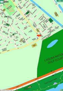
Start at Pasir Ris. Meet at Fitness Corner at Pasir Ris Town Park (directly opposite empty field fronting the bus interchange and White Sands shopping centre.

From Pasir Ris to Tampines Ave 1 via park connector - Bedok Reservoir Rd - Bedok Reservoir Park Connector - Bedok Town Park - Bedok Reservoir Neighbourhood Park - Siglap Park Connector - East Coast Park - Bayshore Rd - Upp East Coast Rd
End at Bedok Corner. Opposite the Bedok Army Camp.

Hey tekko, ..I noe how to use the jogging calculator!! once u got the start point, u need to " click point by point" along your route. Den once you reach the end point, click on " end". You should be able to get your distance le. Do not use mozilla or firefox. use iE instead. - GR
ReplyDeleteThanks but there seems to be something wrong with the site itself. The line doesn't follow when I click the various point.
ReplyDeleteCome join us for the run tomorrow?
Tekko